Pian della Mussa alpine pastures, from the Pian della Mussa car park


Edited by:
Marco Andreis
Updated at: 08/06/2025
Introduction
The Alpe della Rossa trail is a short but pleasant excursion that touches the mountain pastures on the hydrographic left of the Pian della Mussa basin in Val di Lanzo. It is an easy route, suitable for practically everyone, which takes place on well-marked paths and partly flat pastures; the walking time may vary depending on the number of stops and a walking speed that allows you to adequately enjoy the alpine flowers, the fauna and the beautiful landscape in general. The side of the valley, on which the alpine pastures are located, is entirely south-facing and therefore very sunny, also due to the total absence of tall vegetation; however, there is a good presence of water, generally drinkable. The stretch between the Alpe della Rossa and Lago del Ru and Lago Mercurin is more demanding, especially due to the length of the route and the fact that the path may be barely visible at times when crossing stony outcrops and rocky outcrops. This section is strongly discouraged if there is a threat of bad weather or fog and low clouds.
Description
At the western edge of Pian Della Mussa, park the car near the monument dedicated to the bersaglieri, just before the small road leading to the Rifugio Città di Ciriè.
At the foot of the high bastion of rocks to the west, a characteristic construction is clearly visible under a large rock: this is the Alpe Rocca Venoni, a very ancient alpine pasture, of which there are records dating back to Roman times, which can be reached in a few minutes from the car park by taking the path that leads to the Gastaldi Refuge; from the alpine pasture, head back east towards the Ciriè Refuge, crossing the stream again and climbing a few dozen metres towards the Alpe Giasset, a beautiful alpine pasture that has recently been renovated, to reach the refuge esplanade.
The Rifugio Città di Ciriè, in addition to adequate accommodation, offers excellent cuisine and, especially in summer, a panoramic open-air area where it is extremely pleasant to stop for a bite to eat, have a drink, or enjoy the sun and fresh air in the presence of the peaks of the Alpine chain bordering France.
To the right of the hut, a signposted path starts, which immediately climbs very steeply and with a few bends takes you alongside the Rio della Ciamarella, which rushes down into the valley, bubbling and foaming, forming an impressive waterfall; The slope of the path becomes gentler and climbs with the stream on the left and on the right the mass of a large rocky outcrop (clearly visible from the Piano), which in past decades was the site of rich finds of a much-appreciated variety of Grossularia garnet, dark red in colour, which can even be seen on display in museums outside Italy.
In about 45 minutes, we reach the pleasant basin of Pian Ciamarella, where the buildings of the Alpe della Ciamarella stand; this is a wide, almost flat expanse of meadowland where, during the summer, one can count numerous grazing cows, but which offers its best aspect before the mountain pasture, between May and June, when the evident dark green patches of the numerous alpine rhubarb colonies are interspersed with wide spaces with spectacular flowering.
From the 2114m of the Alpe della Ciamarella, neglecting the path that continues northwards in the direction of the Ghicet di Sea, we cross the plain to the right, heading eastwards, and ascend, on a clearly visible path marked with red and white notches, a more barren slope, passing downstream of the last rocky offshoots that branch off to the west of the Punta Rossa di Sea.
At the end of the ascent, having reached an altitude of around 2200m, it is worth taking a break (especially if the day is clear): starting from the south, beyond the Pian della Mussa, you can see Monte Bessanetto and the Beccas d'Arnas, both slightly lower than 3000m, then, towards the west, all the peaks of the border ridge, Punta d'Arnas, Punta Maria, Punta Teja, Punta di Balme, Punta Rosenkrantz and all the long, jagged ridge that ends with the 3600m of the Uja Bessanese, and then descends towards the Collerin ridge and the Pian Gias glacier, and finally ascends to the 3676m of the Uja di Ciamarella and the 3262m of the Punta Albaron di Sea, which closes the view to the north-west.
At this point you are on pastures that stretch slightly uphill to the east, the area is very beautiful: to the right the view of Pian della Mussa 500m further down and to the left and in front the steep offshoots of Punta Rossa di Sea, the Speroni di Sea and Uja di Mondrone.
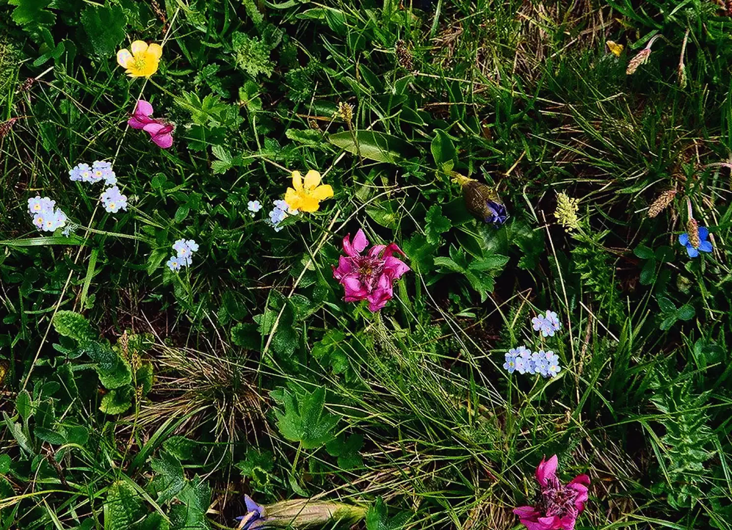
We continue, taking care not to lower our altitude and following the red and white painted posts and cairns that indicate the right direction, in a succession of flowering alpine meadows: gentians, gentians, narcissus flowering anemones, forget-me-nots, saxifrages, alpine clovers, white lilies, daphne and patches of rhododendrons.
As with all stretches over pastureland, the path is often less obvious, so it is advisable to take particular care in case of fog, although any modest digressions may not be the cause of major dangers.
Following the marked tracks, we soon arrive at the Alpe della Rossa (2229m), a single two-storey stone building with a watering trough in front of it, at which excellent water gushes out; the alpine pasture is practically unused, although it must once have been of a fair size, as the numerous remains of buildings in the vicinity testify.
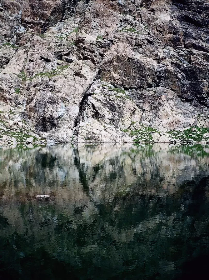
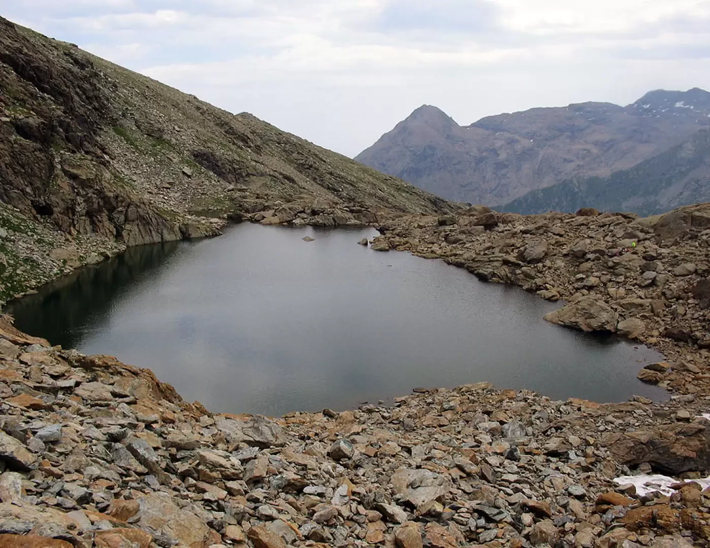
For those who want to, it is possible to follow the path that goes further east, beyond the alpine pasture, through a stony, lunar landscape, and in a couple of hours arrive at Lago del Ru and Lago Mercurin, embedded just below the Uja di Mondrone.
The route from the Alpe della Rossa to the lakes takes place in a very wild environment, amidst scree and substantial rocky outcrops that descend from the offshoots of the Punta Rossa di Sea to form the Torrioni del Ru, immediately above the village of Balme.
The path runs with a long traverse, from west to east, very scenic, alternating between flat or almost flat stretches and modest uphill stretches that climb over the various ridges encountered; then, just before the lake, after a superb view of the western slope of the Uja di Mondrone, the path dips slightly into a stony basin until it reaches the Lago del Ru, and then climbs over a last ridge from the top of which it is already possible to see the Lago Mercurin, deeply embedded under the Uja.
Returning to the initial route, from the Alpe della Rossa, the path bends down the valley and westwards, passing above the Béc d' Cücia, and descending through steep pastures, in about 20 minutes, to the Alpe Rulè: three perfectly aligned buildings with their short south-facing façade looking down on the Pian della Mussa below.
The whole area between Pian Ciamarella and Alpe della Rossa, in the spring, is an excellent opportunity for sightings, even very close, of groups of ibex in search of the first grassy patches left free of snow.
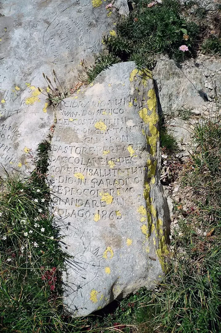
We continue our descent until we reach a small plateau below, then, having left the path, we cross the same plateau to the west until we come to the rocks and fir trees that border it, where, with a little "eye" it is possible to see the remains of an ancient icehouse, consisting of a cavity that descends into the depths of the ground, where, at the beginning of the 1900s, ice was stored to supply the hotels in Pian della Mussa during the hot season;
since the artefact is embedded in the rocks and somewhat hidden by vegetation, caution is advised to avoid ruinous falls.
Retracing the original path, we soon reach the Pian della Mussa near the Grange della Mussa, an alpine pasture still in use and consisting of a cluster of buildings offering interesting views.
In the vicinity of the Grange della Mussa, you will find the Bricco Restaurant, a well-known destination for robust gastronomic stops of which you will hardly have cause to regret!
From this point onwards, simply turn right and follow the road back to the car park of departure.
Photo gallery
Comments (0)
Sign in to leave a comment